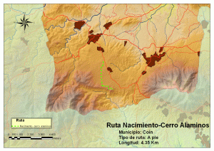
 Nacimiento Cerro Alaminos, Coín
Description
The route starts at the recreation area of Nacimiento de Coin where we park the vehicle. Seek the path of the Spring between the pines a few hundred yards from the Nacimiento. We will follow it up to the recreational-sports complex in the Llanos del Nacimiento, an area frequently visited by residents of Coin and surrounding municipalities. From here, continue to the left, continuing on the Way to the Fuente that will lead to the Llano de Matagallar, of special environmental and botanical importance since it constitutes the most important water supply area of Coin and has protected species of orchids amongst the floristic diversity. Once you cross the plain whilst enjoying the views, we will take the Camino de la Fuente through the pine forest that will guide us to a crossroad where we change direction, continuing to the left on the road to Cerro Alaminos. Again we resume the walk between pines until reaching the viewpoint of Cerro Alaminos, the end of the route.
Charcón,Valle de Abdalajís
Description
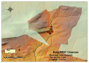
This short route (PR) starts in the village and ends at the farmhouse of Charcón Torcal. The route begins at the Plaza San Lorenzo and crosses the streets of Real, Fuente, fresca, Sol and Calvario. From there, we have the option to climb to the chapel of Cristo de la Sierra and Gangarro viewpoint (from which you can see beautiful views of the town and surrounding area), or take the path of the PR which appears to right. Staying on the path all the time, it begins climbing up a river bed surrounde by high limestone walls. The trail gradually climbs in zigzag until the Cortijo del Charcón,offering beautiful panoramic views of the entire area as well as of the incredible rock figures of el Torcal. Route Options: – Going up to the hill Chapel. – To complete our journey to the village it is recommended to continue down the path PR-A 85, that is, by the farmhouse of the Rejonada, after a walk around the Torcal.
El Nacimiento
Description
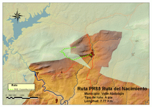
The route starts at the Plaza de San Lorenzo, located right in the center of town of Valle Abdalajís as we leave the town we seek the path of El Nacimiento to be found next to a school. The path runs on a large flat area close to rocky walls and cliffs called Tajos del Cuervo, where it is usual to see rock climbers. The roads are quite broad, well defined and even a small stretch of it runs along a paved road. After completing the paved road we find a signposted junction; to our left we can see the farmhouses of Tajo de las Peñascales and Palmitas, surrounded by wheat fields and olive groves. On our right we find the way we have to follow on the path that goes along the Gaitanes Gorge, where we will see the signs of «Nature Area», informing us that we are entering a protected area.
Pizarra
Description
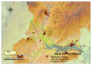
The route of Pizarra will allow us to enjoy the scenery of a typical Andalusian village. We start our tour in the Tourist Information Office where you can obtain information on the town. Then continue walking until you reach the Plaza de la Cultura and we go into the historic center of town where we find the Church of St. Peter the Apostle with its square and the magnificent Palace of the Counts of Puerto Hermoso. Precisely in this square is where the village of Pizarra originated more than five hundred years ago after the divisions made by the Christians during the Reconquest. One of the oldest streets in Pizarra starts at this square, Calle Real, which we now take until we get to the Plaza del Ayuntamiento, with the Town Hall, to continue by Calle Alta visiting the Convent of the Sisters of the Cross on the way. Continue along Calle Alta to the Barrio Alto and the street Puertecillo until reaching the entrance of Raja Ancha Recreation Park, the end of the route, where we can rest awhile and enjoy nature.
The Three Crosses
Description
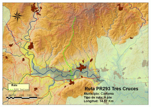
The road to Tres Cruces, is a linear path of 14 km in length that leads from the town of Cártama to the Hermitage of the Three Crosses, situated on the boundaries of Alora, Almogía and Cártama. This shrine becomes a meeting point on the first Sunday in May when verdiales Festival, declared of National Tourist Interest, take place here. Our route starts at the urbanization Vistas al Valle de Cártama, opposite the municipal sports center, crosses the River Guadalhorce and arrives in Nueva Aljaima, a district of Cártama, where a climb of about 600 m level begins on the way of the Three Crosses leading us to the beautiful scenery of the Hermitage. During the walk we enjoy excellent views of the Guadalhorce valley and the mountains which surround it offering us the possibility to watch birds of prey.
Description
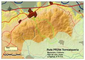
The route of Torrealquería is a loop trail of 8.8 km. around the valley formed by the mountains of the Sierra Espartales and Llana. Our tour begins at the Parque del Santo Cristo and continues to the urbanization Huerta Primera and the road to the Hermitage. Start climbing through Montoro, Campo Viejo, Sierra Llana and Viñas Viejas until connecting back to the road leading to the Hermitage of Our Lady of the Remedies where our tour concludes. The main feature of this route is the wonderful views of the Guadalhorce valley and the mountain ranges surrounding it.
Espartales
Description
This loop trail, approximately 9 km long, starts at the Santo Cristo Park and continues down the path that leads us to the mountains Espartales de Cártama. At the beginning we can enjoy the Trascastillo aqueduct and bridge as well as the aqueduct of the Mata. Then the climb begins to reach the peaks Gordo and Santa Isabel, it descends and then again begins to climb the mountain of Espartales through the Sierra del Almendral, Sierra Llana, Viñas Viejas, Montoro and Trascastillo. Finally, the path will lead us to the Shrine of Our Lady of Remedies and the Water Tower and to the source of Pilar Alto where the road ends. This route is notable for its botanical interest and landscape.
Chorro – Valle de Abdalajís
Description
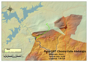
In the Nature Area of Los Gaitanes, we start from the apartments La Garganta. Here we take a paved road (Alora road) to access the railway station of El Chorro, where the trail enters Mount Haza del Rio, at the foot of the mountain range of Sierra de Huma, running under the cliffs to the village of Valle Abdalajís. The whole area is characterized by Aleppo pine, oak, juniper and Mediterranean scrub, but it is especially famous for its breathtaking views and the enormous height of the cliffs.
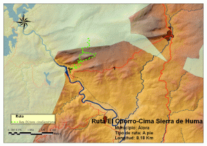
Route El Chorro – Huma Peak
Description
A stretch of this route is part of the GR-7 (Great Route) which runs from Algeciras to Athens. Begin the tour at the station of El Chorro, after arriving by car from the village of Alora, on the road coming from the area of Valle del Guadalhorce and Malaga. At the start of the route, we can enjoy the view from the station, getting an idea of the landscape that we are going to enjoy, the deep canyons and gorges, vertical walls, a real spectacular enclave. We walk through the village of El Chorro, and when reaching the end, taking a right, is the start of this route. We enter a forest of Aleppos, on a wide path closed by a safety bar limiting the entrance of motor vehicles. Continue on this road following the milestones of the GR-7 (one white and one red). As we climb, we come upon the first rock climbers. We can continue the marked path , or take a path on the left that goes along with the vertical walls until we find the Arab stairs built on the limestone. We climb these and the path will guide us to a spectacular view of the station of El Chorro, the reservoir of La Encantada and in the background the mountain range of Sierra Alcaparaín, with its highest peak, El Grajo. A little later, we reach an area called the Puertecillo, where we have a fence damaged by the constant passage of people and animals, whcich we open to continue the path that will lead us to the top of Sierra Huma, where you can enjoy spectacular panoramic views of the surroundings and enjoy some of the fauna of these mountains such as the griffon vulture and mountain goats.
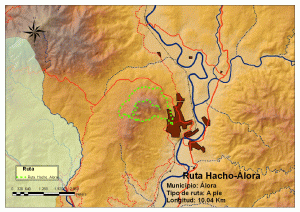
Route Hacho- Álora
Description
From the Plaza del Ayuntamiento, we head down the street of Santa Ana. It is a steep slope up to the football field. From there it has A beautiful view of the castle and town can be enjoyed from here. The mount Hacho rises to the left. To the right lies the Guadalhorce valley. We take the left road and climb up between almond and olive trees. Soon after, we find an intersection: with the Sanctuary of Our Lady of the Flowers to the right and the climb to the Hacho to the left. During the climb, we can see a beautiful view of the town and valley. For reference, in a crossroad, we find an antenna. We leave this one to our right and continue to a second antenna, close to the Cross of Alora one of the highest points of the Hacho that can be visited.
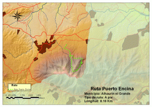
Route Puerto de la Encina
Description
The route begins at the forest road, just where the pine forest starts indicated by a reserved area sign. Follow the road always rising to the Acebuche Fountain, built in 1913. Behind the fountain there is path leading through the grove of mastic trees and carob trees that we follow. This trail runs in the first stage through an area mostly of large pines, giving way, as we ascend, to a shady area, rich in ferns, growing between the pines and lichens, indicating the good air quality. After passing through the pines and over the surface with ferns and lichens, we enter a place dominated by oak and kermes that soon turn into steep limestone walls with little vegetation as we move along. This point of the route is known popularly as the «area of the gorges» because of the great number of these to be found in the place, and this is where we find the largest canyon of the whole route. Once we leave the gorge area, we begin an ascent where again the predominant vegetation is Holm oaks and kermes to indicate that we are very close to Puerto de la Encina (Pass of the Holm) where we can take a break and enjoy the surroundings. From Puerto de la Encina we follow the path that we find to the right of the esplanade, perfectly defined, and begin a descent through the forest of oaks and pines until reaching the house of the forest guards. Once at the house, we take a left lane in search of the path that will lead us back to the Forest Road.
